There are a few changes to the forecast for Wednesday and Thursday, but not many.
Areas north of I-44 could get at least a foot of snow.
The Springfield and Branson areas could see five to eight inches.
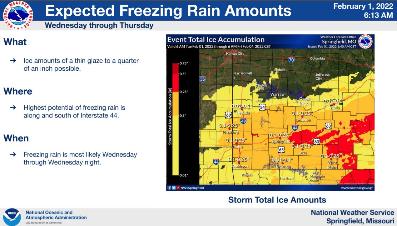
Ice accumulations will be mainly along and south of I-44.
Anywhere from a tenth of an inch to a quarter of an inch is expected.
The Joplin and Anderson areas will see less than a tenth of an inch, along with areas north of I-44.
Here is the latest update from the National Weather Service:
Original Story
Heavy snow is expected across the Ozarks Wednesday, along with some ice.
A Winter Storm Warning is in effect from Tuesday night through Thursday at midnight.
The National Weather Service says the heaviest amounts will be north of I-44.
Eight to twelve inches of snow could fall in Central Missouri.
The Springfield area could get five to eight inches, while Branson could get three to six.
Ice amounts of a tenth of an inch to a quarter of an inch will be possible mainly along the I-44 corridor.
The Branson area should get less than a tenth of an inch.